Property Record
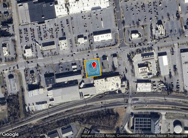
1436 W Main St, Salem, VA 24153

NEARBY LISTINGS FOR SALE OR LEASE
Property Detail
1436 W Main St
140-1-6
900
Commercialnec
PARCEL 5A 0.6340 AC MEMBER ONE FEDERAL CREDIT UNION
X
Salem City
51161C0137G
Virginia
2025
0.63 AC
2025
Southwest Roanoke
010300
Roanoke
3,194 SF
Roanoke, VA
DEMOGRAPHICS near 1436 W Main St
1 Mile
3 Mile
5 Mile
2024 Total Population
4,796
29,266
62,573
2029 Population
4,906
29,820
62,827
Pop Growth 2024-2029
+ 2.29%
+ 1.89%
+ 0.41%
Average Age
45
43
43
2024 Total Households
2,022
11,577
25,426
HH Growth 2024-2029
+ 2.52%
+ 2.04%
+ 0.45%
Median Household Inc
$83,119
$74,264
$66,766
Avg Household Size
2.30
2.30
2.30
2024 Avg HH Vehicles
2.00
2.00
2.00
Median Home Value
$252,133
$261,854
$233,007
Median Year Built
1969
1972
1971
Nearby Places
Map Layers
Map Styles
 Street
 Aerial
- Restaurants
- Banks
- Shops
- Fitness
- Groceries
PUBLIC TRANSPORTATION
AIRPORT
Roanoke/Blacksburg Regional (Woodrum Field)
DRIVE
WALK
Distance
Roanoke/Blacksburg Regional (Woodrum Field)
22 min
12.5 mi
Nearby Properties
Address
Land Use
TOTAL SIZE
Lot Size
Zoning
Address
Land Use
TOTAL SIZE
Lot Size
Zoning
81,148 SF
52.04 AC
CUDRSF
Address
Land Use
TOTAL SIZE
Lot Size
Zoning
288,464 SF
40.14 AC
RSF
Address
Land Use
TOTAL SIZE
Lot Size
Zoning
78,701 SF
31.20 AC
C2S
Address
Land Use
TOTAL SIZE
Lot Size
Zoning
69,831 SF
73.54 AC
HBD
Address
Land Use
TOTAL SIZE
Lot Size
Zoning
155,000 SF
3.78 AC
CUD
Address
Land Use
TOTAL SIZE
Lot Size
Zoning
181,455 SF
6.24 AC
RMF
Address
Land Use
TOTAL SIZE
Lot Size
Zoning
95,349 SF
10.25 AC
RSF
Address
Land Use
TOTAL SIZE
Lot Size
Zoning
76,280 SF
9.51 AC
CUD
Address
Land Use
TOTAL SIZE
Lot Size
Zoning
138,887 SF
13.03 AC
HBD
Address
Land Use
TOTAL SIZE
Lot Size
Zoning
120,584 SF
9.41 AC
HM
Address
Land Use
TOTAL SIZE
Lot Size
Zoning
394,937 SF
25.15 AC
I2
Address
Land Use
TOTAL SIZE
Lot Size
Zoning
565,151 SF
56.04 AC
HM
Address
Land Use
TOTAL SIZE
Lot Size
Zoning
28,221 SF
20.18 AC
RMF
Address
Land Use
TOTAL SIZE
Lot Size
Zoning
161,757 SF
13.22 AC
HBD
Address
Land Use
TOTAL SIZE
Lot Size
Zoning
442,530 SF
40.32 AC
HM
Address
Land Use
TOTAL SIZE
Lot Size
Zoning
47,451 SF
1.58 AC
RB
Address
Land Use
TOTAL SIZE
Lot Size
Zoning
314,182 SF
22.87 AC
HM
Address
Land Use
TOTAL SIZE
Lot Size
Zoning
100 SF
60.09 AC
RSF
Address
Land Use
TOTAL SIZE
Lot Size
Zoning
87,526 SF
4.12 AC
RMF
Address
Land Use
TOTAL SIZE
Lot Size
Zoning
11,613 SF
11.27 AC
RMF
Address
Land Use
TOTAL SIZE
Lot Size
Zoning
74,712 SF
2.13 AC
DBD
Address
Land Use
TOTAL SIZE
Lot Size
Zoning
100,915 SF
13.80 AC
HM
Address
Land Use
TOTAL SIZE
Lot Size
Zoning
178,638 SF
12.01 AC
HBD
Address
Land Use
TOTAL SIZE
Lot Size
Zoning
23,600 SF
24.55 AC
LM
Address
Land Use
TOTAL SIZE
Lot Size
Zoning
52,011 SF
11.63 AC
HM
Address
Land Use
TOTAL SIZE
Lot Size
Zoning
55,503 SF
9.69 AC
HBD
Address
Land Use
TOTAL SIZE
Lot Size
Zoning
76,720 SF
4.90 AC
C2S
Address
Land Use
TOTAL SIZE
Lot Size
Zoning
140,000 SF
8.65 AC
HM
Address
Land Use
TOTAL SIZE
Lot Size
Zoning
68,976 SF
1.77 AC
DBD
Address
Land Use
TOTAL SIZE
Lot Size
Zoning
63,192 SF
3.50 AC
HBD
The World's #1 Commercial Real Estate Marketplace
Connect with us
© 2025 CoStar Group
The information above has been obtained from sources believed reliable. While we do not doubt its accuracy we have not verified it and make no guarantee, warranty or representation about it. It is your responsibility to independently confirm its accuracy and completeness. Any projections, opinions, assumptions, or estimates used are for example only and do not represent the current or future performance of the property. The value of this transaction to you depends on tax and other factors which should be evaluated by your tax, financial, and legal advisors. You and your advisors should conduct a careful, independent investigation of the property to determine to your satisfaction the suitability of the property for your needs.